This website is kept for archival purposes only and is no longer updated.
|
|
The United States at Night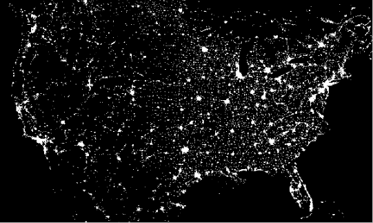
The above picture is actually a composite of over 200 images made by satellites orbiting the Earth. The scans were made by the USAF Defense Meteorological Satellite Program (DMSP) Operational Linescan System. The DMSP satellites continue to help in the understanding and prediction of weather phenomena as well as provide key information about population patterns, city light levels, and even rural forest fires.
This map is available as a poster through the DMSP web page.
NASA's Earth Observatory web site has a page with an image of the entire Earth at night.
This file was last modified January 18, 2003 |